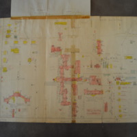
Map of the Hospital Area
Dublin Core
Title
Map of the Hospital Area
Description
Hand drawn color map of State Hospital buildings, perhaps an early draft of a Sanborn map.
Creator
unknown
Source
Folder ca. 1910 - 1946, Box 1, S190085, South Carolina Department of Archives and History
Date
1941-09-02
Contributor
Digitized by: Meg Southern
Equipment: iPhone 4
Date digital: 2014-03-29
Equipment: iPhone 4
Date digital: 2014-03-29
Rights
This is a digital image of an archival item held by the South Carolina Department of Archives and History. Digitizing Bull Street has made this content available for educational and scholarly purposes.
Identifier
Southern_18
Files
Collection
Citation
unknown, “Map of the Hospital Area,” Digitizing Bull Street, accessed May 10, 2024, https://www.digitalussouth.org/bullstreet/omeka/items/show/532.

